GOZ011 - Il-Qattara
Description
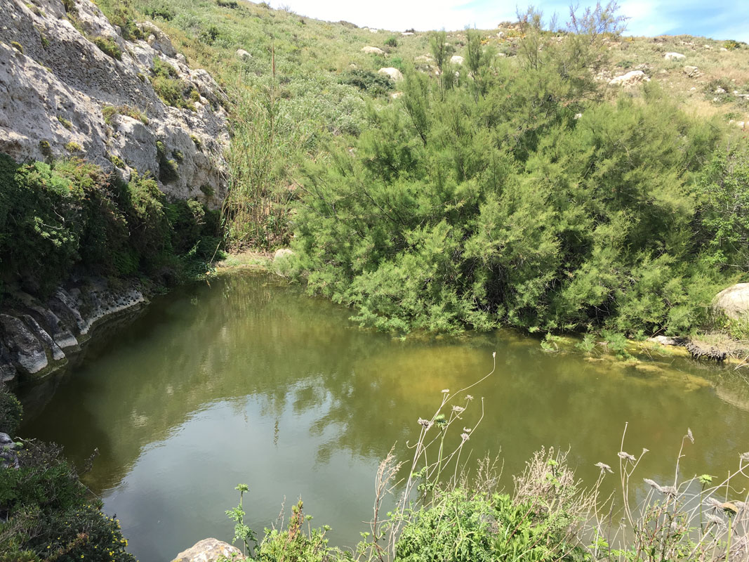
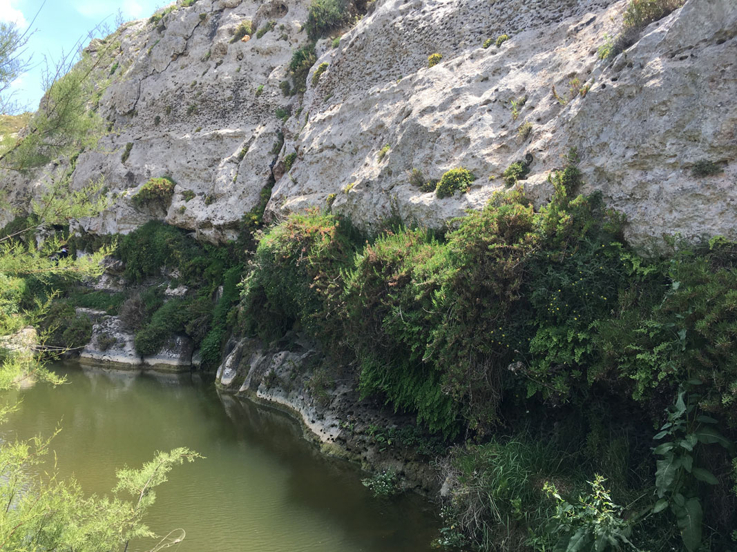
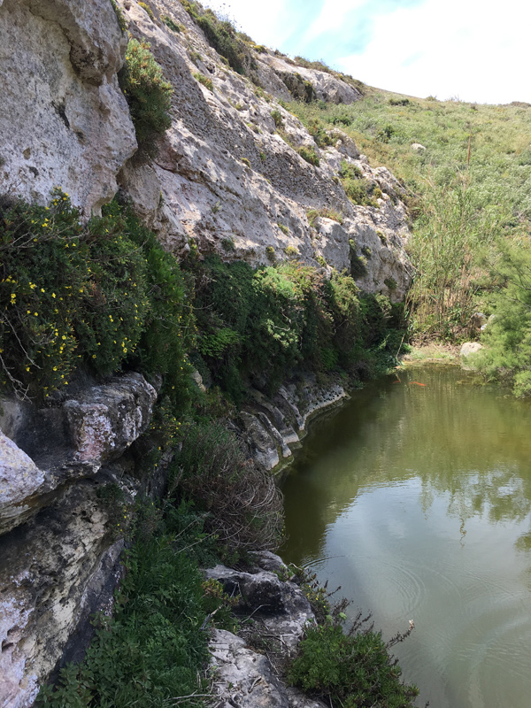
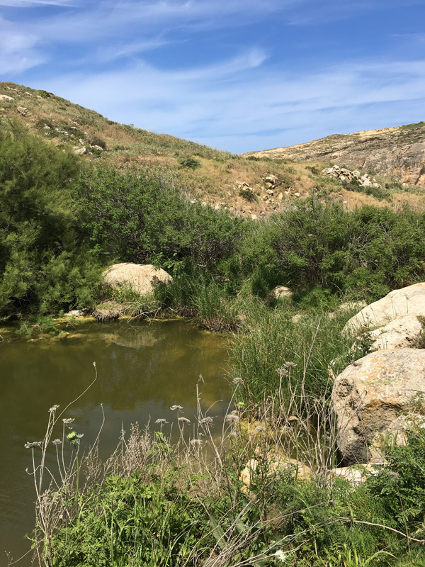
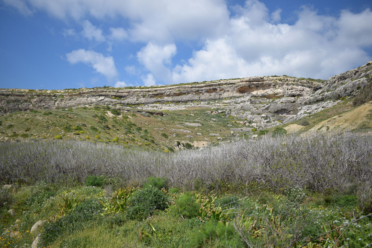
Il-Qattara is a permanent freshwater natural pool, located along the eastern wall of the hollow that is connected by an intermittent watercourse to the Inland Sea. The pool is fed by a perennial spring seeping from the walls of the hollow. Seepage extends along the entire escarpment and is channelled into the pool by a man-made ledge carved into the rock (Lanfranco and Cassar, 2007). The pool is scheduled as an Area of Ecological Importance and a Site of Scientific Importance and is designated as a Tree Protection Area. The site also lies within a Natura 2000 site.Evidence of an underground rock cut gallery is found at il-Qattara (Nature Trust (Malta) et al., 2005). Groundwater is mostly used for agricultural practices in view of the lack of other land uses in the management plan area. Over-extraction of the groundwater would lead to further sea water intrusion in view that the SAC and SPA is found in the vicinity of the coast.Zannichellia melitensis and Chara globularis are known to grow in this pond (Cassar et al., 2004). Other hydrophilic species inhabit the banks of the spring, including Rumex bucephalophorus, Mentha pulegium, Cyperus longus and Scirpoides holoschoenus. The structure of this habitat is well conserved despite a large number of visitors visiting the area all year round. Unfortunately, however, goldfish have been introduced into the pool and were recorded by Cassar et al. (2004).

Wetland data
Basic information
| Wetland location: | Inland |
| Wetland type: | Natural |
| Wetland area: | 0.10 Ha |
| Hydrological interaction: | - |
| Water salinity: | Fresh (< 0.5 g/l) |
| Type of fresh water input: | Karstic spring |
| Surface water runoff | Other |
| Open water area (%): | 5 - 25 |
| Hydroperiod: | Permanent |
Geographic information
| Census district: | Gozo and Comino |
| Island: | Gozo |
| Local council: | San Lawrenz |
| Longitude: | 14.192530 East |
| Latitude: | 36.051310 North |
Wetland condition
| Wetland status (MEDWET): | 2 - Original habitats/landform still predominant (>50%) |
Ramsar wetland type
| Type | Coverage (%) |
| Tp -- Permanent freshwater marshes/pools; ponds (below 8 ha), marshes and swamps on inorganic soils; with emergent vegetation water-logged for at least most of the growing season |
Property status
| Public |
| Protection status category | Protection status subcategory | Area's name | Code | Coverage area (%) | Legislation |
| National | Area of Ecological Importance/Site of Scientific Importance | Id-Dwejra u l-Qawra, limiti ta' San Lawrenz u Kercem, Ghawdex | 555546301 | 100 | Development Planning Act (Act VII of 2016) |
| National | Area of Ecological Importance/Site of Scientific Importance | Ghadajjar ta' l-ilma helu fil-Qattara, Dwejra (l/ta' San Lawrenz, Ghawdex) | 555546301 | 100 | Development Planning Act (Act VII of 2016) |
| National | Area of High Landscape Value | Dwejra | 555546312 | 100 | Development Planning Act (Act VII of 2016) |
| National | Bird Sanctuary | Il-Qawra, Ghawdex | 194414 | 100 | Environment Protection Act (Act I of 2016) |
| International | Special Areas of Conservation - International Importance | L-Inhawi tad-Dwejra - Qawra, inkluz Hagret il-General | 330731 | 100 | Environment Protection Act (Act I of 2016) |
| International | Special Protection Areas | Rdumijiet ta' Ghawdex: Il-Ponta ta' San Dimitri sal-Ponta ta' Harrux | 555552411 | 100 | Environment Protection Act (Act I of 2016) |
| National | Tree Protection Area | Il-Qattara (limiti ta' San Lawrenz) | 555546275 | 100 | Environment Protection Act (Act I of 2016) |
| International | Important Bird and Biodiversity Areas | Dwejra Bay to San Dimitri Point | MT011 | 100 | |
| International | Pools | Il-Qattara | MT SW 01 | 100 | Water Framework Directive |
| Other | Scheduling - Archaeology | Buffer zone for road, basin and rock-cut site | 1 |
CDDA protection status
| CDDA code | CDDA category |
| MT02 | Area of Ecological Importance/Site of Scientific Importance |
| MT15 | Area of High Landscape Value |
| MT03 | Bird Sanctuary |
| MT11 | Special Areas of Conservation - International Importance |
| MT13 | Special Protection Areas |
| MT06 | Tree Protection Area |
Important bird areas
| IBA code | Site name | Coverage (%) | References |
| MT011 | Dwejra Bay to San Dimitri Point | 100 |
Ecosystem services
| Type of ecosystem service | Ecosystem service | Scale of Βenefit (%) | Importance |
| Provisioning services | Fresh water | ||
| Regulatory services | Water regulation |
Activities on wetland
| Activity | Intensity |
| 020 = Resource conservation | Low |
| 701 = water pollution | High |
| 702 = air pollution | High |
| 703 = soil pollution | High |
| 920 = Drying out | Low |
| 954 = invasion by a species | Low |
Activities on catchment area
| Activity | Intensity |
| 010 = Habitat conservation | High |
| 501 = paths tracks cycling tracks | Low |
| 502 = roads motorways | High |
| 608 = camping and caravans | Medium |
| 701 = water pollution | High |
| 702 = air pollution | High |
| 703 = soil pollution | High |
Impacts
| Impact | Intensity |
| EB- = Increase in aesthetic qualities | Low |
| ES- = Increase in water supply | High |
| EU- = Increase of tourist/recreation potential | High |
Habitat types
| Type | Coverage (%) |
| 3140 Hard oligo-mesotrophic waters with benthic vegetation of Chara spp. | 26 - 50 |
Vegetation types
| Type | Coverage (%) |
| Other | |
| Emergent | |
| Submerged | |
| Ammophilous | |
| Shrubby / Arborescent | 5 - 25 |
| Halophytic | |
| Floating-leaved | |
| Wet meadow | < 5 |
Flora
| Species | Presence status | References |
| Arisarum vulgare | ||
| Arundo donax | ||
| Asparagus aphyllus | ||
| Bituminaria bituminosa | ||
| Chara globularis | ||
| Cyperus longus subsp. badius | ||
| Galium aparine | ||
| Geranium molle | ||
| Hedysarum coronarium | ||
| Hyoseris frutescens | ||
| Rumex bucephalophorus | ||
| Salix alba | ||
| Scirpoides holoschoenus | ||
| Silybum marianum | ||
| Tamarix africana | ||
| Urginea pancration | ||
| Vitex agnus-castus | ||
| Zannichellia melitensis |
Fauna
| Mammals | Presence status in wetland | References | |
| Myotis punicus (Felten, 1977) | |||
Birds |
Number of individuals |
Nesting |
References |
| Gallinago gallinago (Linnaeus, 1758) | |||
| Ardeola ralloides (Scopoli, 1769) | |||
| Nycticorax nycticorax (Linnaeus, 1758) | |||
| Emberiza calandra (Linnaeus, 1758) | |||
Amphibians |
Presence status in wetland |
References |
|
| Discoglossus pictus (Otth, 1837) | |||
Fishes |
Presence status in wetland |
References |
|
| Cyprinus carpio (Linnaeus, 1758) | |||
Invertebrates |
Presence status in wetland |
References |
|
| Augyles (Littorimus) maritimus (Linnaeus, 1758) | |||
| Lymnaea truncatula (O. F. Müller, 1774) | |||
| Mercuria cf. similis (Draparnaud, 1805) |
Adi Epsilon Consortium (2014h) L-Inhawi tad-Dwejra – Natura 2000 Management Plan (SAC). Prepared for the Malta Environment and Planning Authority under CT3101/2011. San Gwann, Malta, pp. 112 + Annex
ERA (2015) The 2 nd Water Catchment Management Plan for the Malta Water Catchment District 2015 - 2021
Images